Geographical location and topography
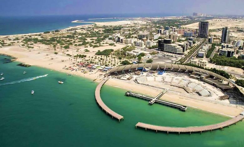
Kish Island with an area of 91 square kilometers, a coastline of 43 kilometers and an almost oval shape, in the distance 18 kilometers from Bandar Aftab is the continuous land of Iran in the Persian Gulf. Kish is located in the first quarter of the southern coast of Iran at the mouth of the Persian Gulf and almost near the end of this waterway in the Strait of Hormuz. Its northern latitude is 32 26 degrees and its eastern longitude is 53 58 degrees, and it is 45.15 kilometers long in the direction of the west coast - to the east coast. The maximum width of the island along the south coast to the north coast is 5.7 kilometers. The surface of the island has no special topography, such as the phenomenon of mountains and even high hills. Kish International Airport is built in the center and in its high part, which is about 40-35 meters high. The steepest slope of the island is from the north of the airport towards the beach.
Geographical and climatic features
Sub-climates Kish Island is strongly dominated by the phenomena caused by the large water bed, which has a very small fluctuation range of day and night temperature changes during the year. The water vapor pressure of the island is often very high during most of the year. The average daily temperature difference of the island throughout the year is less than 9-10 degrees, and the temperature never drops to freezing or zero.
The weather in Kish is mild and pleasant in the months of October to April, and during this time the island is in favorable environmental conditions. From May to October, the weather in Kish is warm, Sultry and the average daily temperature of the island in these months is almost the same. In Ordibehesht, because the sea water is still cold and the relative humidity is low, the air in Kish is almost dry and the wind is mild, cool and breezy.
The temperature difference between the hottest and coldest months of Kish is about 16 degrees. That is, January has the least evaporation and the coolest and driest month on the island, and August is the month with the highest evaporation and the hottest month on the island. Although Kish is located on a salt dome, unlike other islands (such as Qeshm), the top of the underlying salt domes has not yet risen much, and therefore, fortunately, the geological situation of the island is such that their penetration into the ground causes the salinity to rise. It is not possible, and with some measures, it is possible to keep the rainfall in the dams for a long time after each rain and make maximum use of them.
